
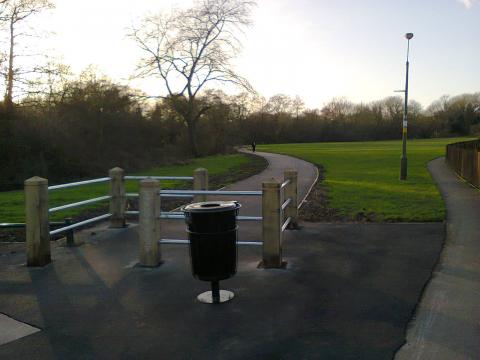
The Merritts Brook Greenway is a new cycling and walking route that runs from Stirchley to just short of Frankley Reservoir, built using LSTF money. A winding and at times ludicrously narrow shared-use path that ends in nowhere in particular, it is none the less pleasant as a leisure route. Yet it is hard to see how novice and very young cyclists will get to it unless they live on the route, as it has no connectivity with any other off-road cycling facility, though an on-carriageway section does get quite close to the Worcester and Birmingham canal in Stirchley.
 Some sections are finished in smooth bitmac, but other sections are finished with unswept spray and chip. The spray and chip section between the Bristol Road and Cob Lane is particularly challenging, as it is also narrow, twisty, and unlit. However, it is not as narrow as the section between Cob Lane and Bournville Lane*. This is so narrow that two cyclists with straight bars would not be able to pass each other, and pedestrians are presumably supposed to move off the path to let cyclists pass. This section is also unlit, and disappears under leaves in Autumn.
 At Bournville Lane cyclists are expected to dismount to cross the road (though curiously there is only a CYCLISTS DISMOUNT sign for cyclists heading towards Frankley), and cycle along the pavement to get to the entrance to the boating lake park. This is not the only CYCLISTS DISMOUNT sign on the route; there is a second one where it crosses the Bristol Road. This path is a indicative of everything that is wrong with cycle route design is this country. It's just a cheap way of ticking boxes that keeps pesky cyclists out of the way of motor vehicles. There is in fact a much better parallel route along Charfield Close, which is lit, and finished with brand new bitmac for the very few motorised vehicles that use it. But those vehicles are given wide, sweeping, high speed turns in and out of Bournville Lane, and of course attempting to bring that design into the 21st century will result in a fit of the vapours by all and sundry. However, it is possible to cross Bournville Lane safely here to reach the park (I've been doing it for many years), and the greenway continues on the opposite side.
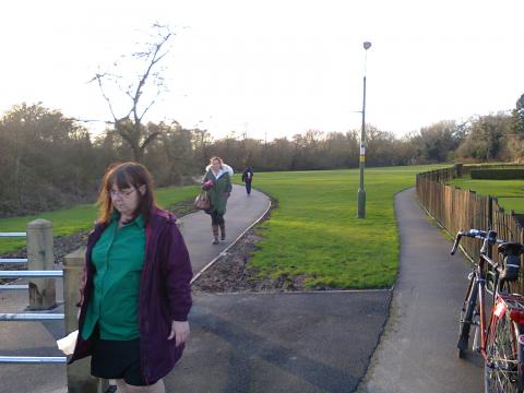
Signage is sporadic, which makes following the route using the signs completely impossible. An absent sign on Woodbrooke Grove resulted in me carrying on up Middlepark Drive, rather than turning right on to Manor House Drive as I should have done. There is also a sign missing in Bournville Park to direct cyclists towards Beech Road. I divined this turn because I had previously seen a sign at the junction of Linden Road and Bournville Lane that directs cyclists along a footpath. In the opposite direction there is a Cycling Prohibited sign on this path. However, despite this I was pleased to see the greenway take this route, because the original plan showed the greenway taking the pavement on Linden Road, and I suggested Beech Road as a far better alternative. Between Bournville Lane and Stirchley there is no signage whatsover, but it is supposed to reach Stirchley (on the carriageway). Bournville Lane does of course lead directly to Stirchley, but to get to the Worcester and Birmingham canal one would need to turn up Franklin Way to get to Mary Vale Road. Bournville Lane is plenty wide enough for segregated cycleways, but there are none, and no plans for them at present.
Money has been found to build wooden arches and the annoying tank traps that the parks department considers necessary, but Sustrans do not. The one shown below was particularly awkward to negotiate, requiring the cyclist to ride on a very narrow footway and make tight 180° turns.


A couple of the tank traps are completely pointless, as they are bypassed by a more direct route that is clearly favoured by both cyclists and pedestrians.
But despite its faults, it is a pleasant route and will appeal to local families with young children who don't care that they can't ride very far. Some may even use it as part of a commute, though the absence of lighting would make that not so pleasant in the winter. Would I use it? Possibly. It runs parallel to part of a route I take from time to time to get me out into the countryside, and it would allow me to cut out some cycling that is not very enjoyable. There is the space to extend the path out to Frankley Beeches and Frankley village, but I don't know of any plans to do that, let alone whether land ownership would make it possible.
Update: The new, beautifully finished bitmac paths have been destroyed with spray and chip. Since they are not especially wide, cycling on them is now slow and difficult. Fences have now been added to force one to use the stymie gates, except for the last one, which can be circumvented using the footpath where my bike is propped. As far as I'm concerned, this is no longer a cycle route, and I wont be using any of the sections that are now covered in loose gravel.
*Push Bikes has been contacted by a reader who tells us that "the section between Cob Lane and Bournville belongs to the Bournville Village Trust, not Birmingham City Council, and hence it's narrow and not well maintained".

