
Bournbrook High Street has had a pop-up cycleway for a little while now. It has some serious issues, but it does tame an unnecessarily hostile road for people on cycles. The good news is that there is now a plan to formalise this connection between the existing A38 cycleway and the cycleways at the Selly Oak triangle junction. Whilst Push Bikes supports the scheme overall, we are of the opinion that it does not meet the requirements in LTN 1/20, the Department for Transport's cycle infrastructure design standards document. So we will be raising issues with the design in our response to the consultation, which closes on 8th July. We urge you to do likewise, even if all you do is respond by saying that you support Push Bikes' views, linking to this web page.
We think the best solution would look much more like the Cycling UK visualisation shown at the end of this article, but we are aware that local shop owners resist change because they mistakenly believe motor traffic brings trade. It has been shown time and again that the reverse is true (trade on New Street increased by 25% when it was pedestrianised, and similar effects have been reported elsewhere). So we will have to live with a compromise, and traders will have to live with their self-inflicted suppressed income. But the new cycleway should not be compromised to the point where it is rendered useless.
There is very little motor traffic on Grange Road, so the parallel crossing on Grange Road seems like over-engineering. Moreover it creates sharp turns and an undesirable shared use area where cyclists and pedestrians will come into conflict, making active travel slow and hazardous. We would suggest one of the following alternatives:
-
Allow contraflow cycling on Grange Road and Dale Road. Heading into the city cyclists could join the carriageway at some point (perhaps just before the tree?) and make a right turn into the shared use area linking Grange Road to the A38. People heading the other way could cycle contra-flow and give way to oncoming traffic before crossing to the cycleway on the opposite side. This short section of contraflow could perhaps be "strengthened" by making it a protected contraflow, or there could be just a protected waiting area for people where they give way to cross to the other side (don't forget some people may want to continue straight on to make a left turn at the main junction). Allowing contraflow cycling like this would have the added benefit of allowing people to cycle from Tiverton Road (a signed recommended cycle route) via Dale Road to the cycleway on Aston Webb Boulevard. -
Make Grange Road and Dale Road two-way for all traffic. This would eliminate the need for protected cycleways on Grange Road, other than a short section near the main junction, and would also open up the Dale Road link from Tiverton Road to Aston Webb Boulevard.
The cycleway design does not but should facilitate people cycling north who wish to stay on the high street (something the existing pop-up lane does). Moreover, section 4.2.7 of LTN 1/20 makes clear the importance of making cycle routes direct, meaning the cycle route should stay on the high street as far as the junction of the A38, not taken on a detour via Grange Road.
Despite there being at present four lanes of motor traffic, the cycleway width is reduced to one lane around trees (it is not clear why there are build-outs for trees, as none exist currently), requiring north-bound cyclists to give way. Section 4.2.15 of LTN 1/20 states that "adequate width is important for comfort". It is not acceptable to force people on bikes to give way to trees so that people in cars can have two clear lanes for driving and an additional lane for parking. That is not conducive to encouraging people to switch from private cars to cycling. If the build-outs are really necessary, then both lanes of the cycleway should be taken smoothly around them (similar to figure 6.24 in LTN 1/20), taking space as required from the parking on the opposite side of the road. Curving the cycle lane will mean the motor traffic lanes will also have to curve, which will help to tame the aggressive driving that is a problem on the high street (a technique already in use in other countries).
There is currently an issue with trucks mounting the pavement to deliver to The Goose pub. This needs to be taken into account in the plan, to ensure the cycleway isn't blocked. This is not a novel problem, and solutions have already been implemented elsewhere (with thanks to Phil Jones Associates for the suggestions below). See also the "Beer Delivery Cycle Superhighway" presentation at the end.

The treatment at North Road is good, but it would be better if that entire square was repaved to look like pavement. Drivers should feel like they shouldn't be there, whilst people walking and cycling are given visual priority. This treatment should be used at all minor side roads.
The pavement at the junction with Dale Road is very busy and does not work as shared use with the pop-up lane. Section 4.2.4 of LTN 1/20 states "Abrupt reductions in the quality of provision for cyclists … will mean that an otherwise serviceable route becomes unusable by most potential users", so the proposed design here will render the cycleway unusable. We suggest connecting the protected cycleway to the junction, and have pedestrians wait for the crossing across the high street on the pavement, similar to the proposal for the pedestrian crossing between Aldi and Hubert Road. Cycle users should be given a suitable phase at the junction, keeping in mind not all will be going straight on.
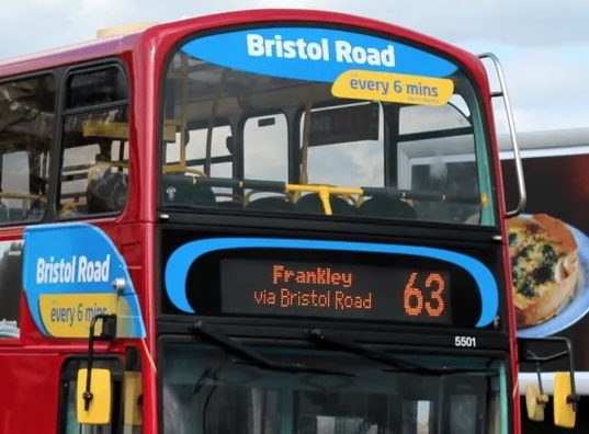 It's not clear what is the arrangement for the shared use by the bus stop outside Aldi. If it is planned to have this as it is now, with the shelter set back from the carriageway, that only works when there is no bus. However, the bus company proudly proclaim on their buses on this route that there is one bus every six minutes. That makes for excellent public transport, but at this busy bus stop it also brings the cycleway to a halt every six minutes for a couple of minutes whilst people get on and off the bus. If the proposal is to move the shelter to the carriageway edge and have cyclists ride along the footway behind the shelter, that will cause a lot of conflict at this high pedestrian traffic location and render the cycleway completely unusable (section 4.2.4 of LTN 1/20). Shared use on this busy pavement as a permanent solution is wholly inappropriate, so we think the bus stop should moved slightly along the road so that it can be made floating (ie best practice - see section 6.6.8 of LTN 1/20), removing car parking on the opposite side of the road as necessary. That said, we are pleased to see buses will wait in the main motor traffic lanes, which will reduce the opportunities for the speeding, and make driving along the high street less attractive.
At the station the cycleway should be made continuous, with the pedestrian waiting area at the crossing set back, similar to the proposal for the pedestrian crossing between Aldi and Hubert Road. That said, what is the plan to connect the route to the station? Is it the ramp further towards the Chappel Lane? If so, it looks very awkward, both for people coming from the station, and for people heading south towards the station. More thought needs to go into this, perhaps integrating a cycle crossing with the existing controlled junction. As it is, we think people will just abuse the pedestrian crossing and connect it with the station entrance using the pavement, so perhaps it's best to formalise that with a properly engineered solution.
The cycleway should be taken up to the junction with Chappel Lane, to connect with the section on Selly Oak High Street. We don't build key roads so they don't connect up, forcing people to drive along the pavement, so why make a cycleway disjointed by design?
Visualisation of Bournbrook High Street


